|
I am a Geospatial Data Scientist who is passionate about the intersections of machine learning, computational statistics, and Geographic Information Systems (GIS) within the social sciences. I am part of the first cohort to receive an MS in Urban Analytics from Georgia Tech. Before that, I received my BA in both Economics and Sociology from Case Western Reserve University, where I specialized in quantitative and computational methods. Currently, I work as a Spatial Data Analyst at the City of Cleveland, in the Department of Urban Analytics and Innovation (UrbanAI). |

|
|
Through both my research and work experience, I have utilized data science and machine learning in a number of applications. From assessing pedestrian accessibility with computer vision, to decomposing street networks to understand their underlying structure, please explore some of my work below. |
|
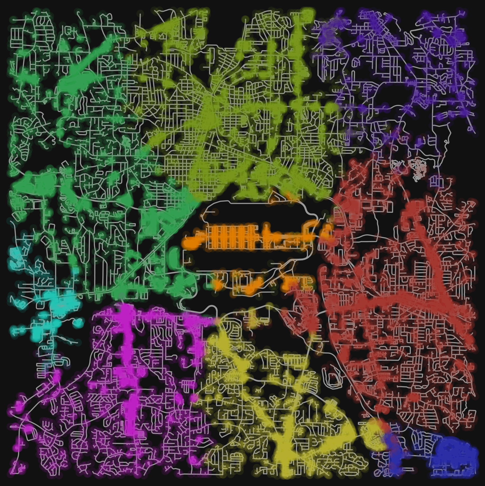
In this project I performed spectral clustering on a street network around the Atlanta Hartsfield-Jackson International Airport with the goal of assessing street connectivity and walkability. I then leveraged American Community Survey data to assess social vulnerability between the resulting clusters. |
|
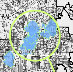
Samuel Martinez, Claire Breeden, Connor Lake, Claire Patrick Using the Yelp Fusion API, I queried the locations of grocery stores, restaurants, schools, and other community points of interest (POIs) in the city of Atlanta. Then, using the Atlanta street network, I performed a service area analysis to find zones where all POIs were within a 15 minute walk of eachother. |
|
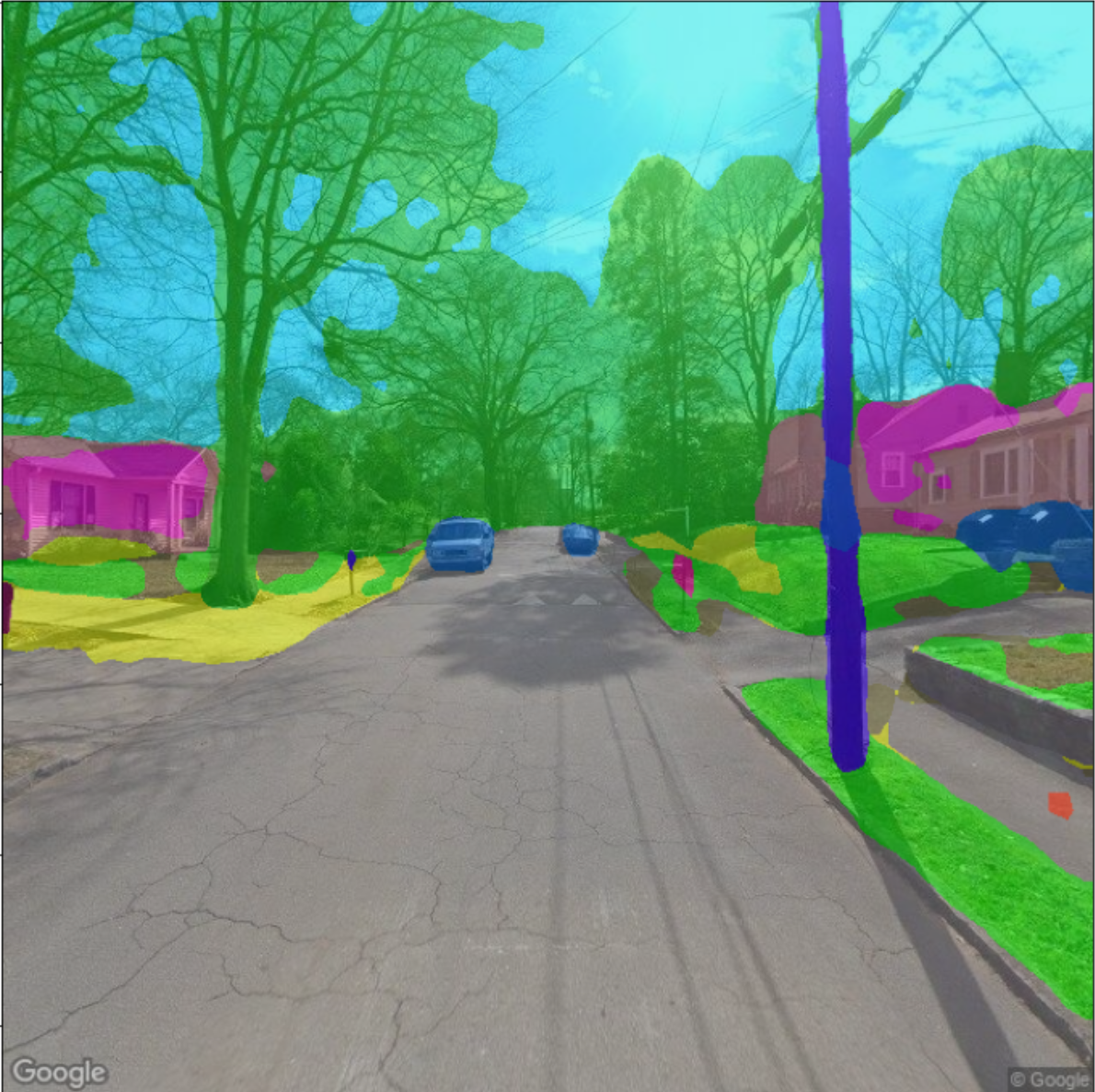
Samuel Martinez, Malavika Murali, Yuxiang Zhao This project performs an analysis of images from Google Street View, with the aim of evaluating the quality of streetscapes in and around the Atlanta BeltLine. Using the PSPNet semantic segmantation model, I classified each image into the proportion of pixels that were foliage, road, building, and more. Using these indicators, we developed a pedestrian accessibility index for each entry point on the BeltLine. |
|
Github | Samuel Martinez, Romy Patel, Rutika Karande, Harry Sharp In this project, I developed a custom dataset and interactive application that visualizes the number of doctor's offices within 25 kilometers of each census tract in the United States. Furthermore, we utilized Gaussian Mixture Model clustering (GMM) to identify high-vulnerability tracts that experience inequitable healthcare accessibility. |
|
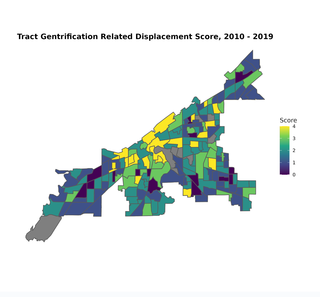
Using an array of classification and feature selection methods, I utilized over 75,000 property transfer and land bank records to identify census tracts that are at high risk for gentrification related displacement in my hometown of Cleveland, Ohio. |
|
If you would like to learn more about any of these projects or any additional work that I've done, please do not hesitate to reach out to me via email. You can find me at sj.martinez218@gmail.com. |